Guide: Installing GPS in quadcopter
Wondering how to install the GPS in your quadcopter, not sure how to set it up? This guide will try to help you.
 |
 |
 |
Hardware
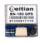
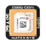
There are many GPS modules that can be used in quadcopters for navigation. One of the most popular GPS modules are Beitian BN-180, BN-220. You can get these modules for less than $10.
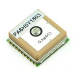
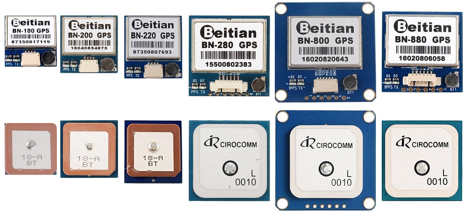
There are basically two types of Beitian modules: ones with the 18x18mm ceramic antenna and others with 28x28mm ceramic antenna. Below is a picture of the relative size comparison of the Beitian GPS modules.
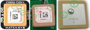
By the way if you see some scratches on the matallic patch of the GPS antenna it is not a lack of QC of the defects of the manufacturing process, but contrary – it is the result of tuning the antenna during final testing. These types of antenna have a nominal tuned frequency, but are impacted by construction, components placed and soldering. Placing small nicks in the centre of the long edges, or corners, brings them into the fine tuning to the right frequency.
How to connect the GPS to Flight Controller
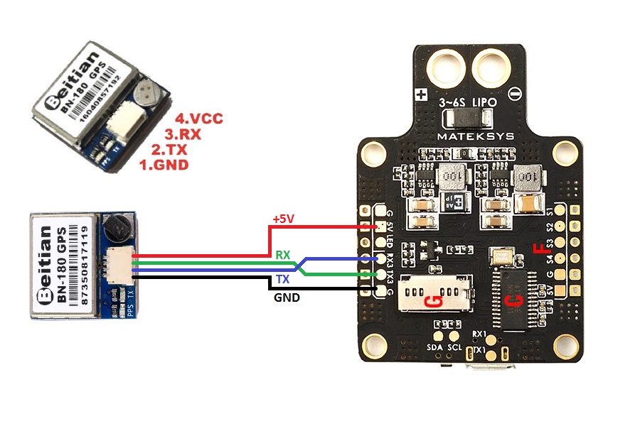
Usually GPS module should be connected to the flight controllers UART interface. Almost any free UART can be used. I don’t recommend to use SoftSerial UART for the GPS connectivity. Connection is pretty simple, just connect GPS TX to FC RX and GPS RX to FC TX.
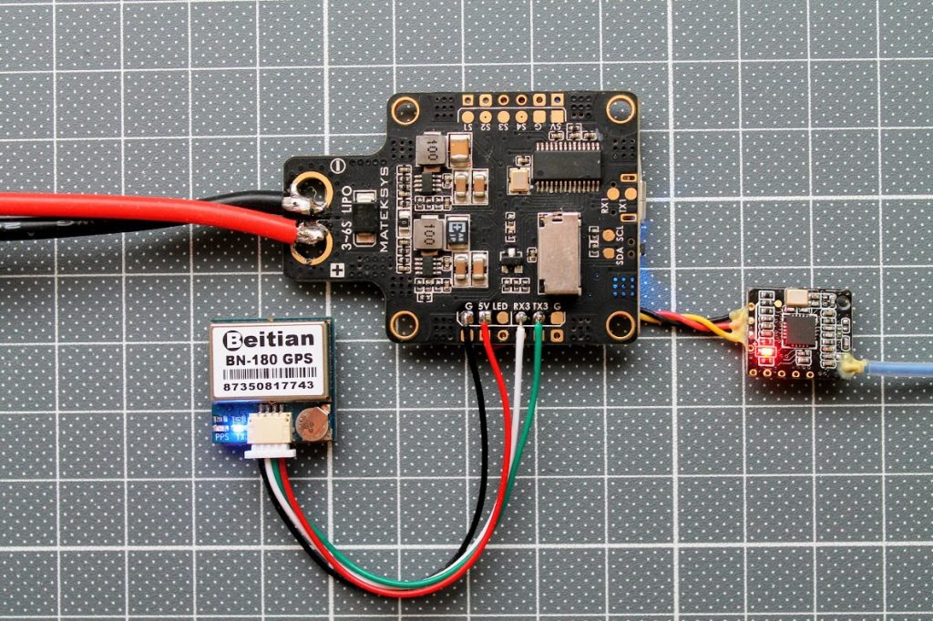
Here is an example of the connection of GPS to flight controllers UART3.
How To set up GPS in Betaflight
Setting up the GPS in Betaflight Configurator is easy, just follow these steps.
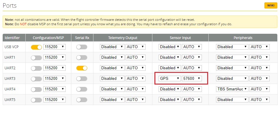
In the Ports tab set the GPS Sensor input to the UART port where GPS is connected. You can select any value in the baud rate drop down list, but the “9600” value results the slowest and the 115200 is the fastest communication rate so the FC takes less time to accuire the coordinates. If you select “AUTO”, then the baud rate will be set to 57600.
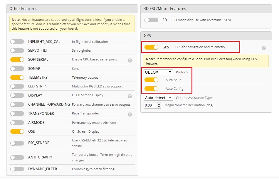
In the Configuration tab, enable GPS Feature. Set the Auto Baud and Auto Config to ON. Select the AutoDetect the Ground Assistance Type. There are two most popular GPS module communication protocols – UBLOX and NMEA . Beitian GPS modules uses UBLOX protocol by default. Try each of these protocols if you are not sure which protocol is used in your GPS module.
If everything is set correctly, GPS module is working and the Flight controller is communicating with it, then you should see the active GPS icon in the Configurator status bar.
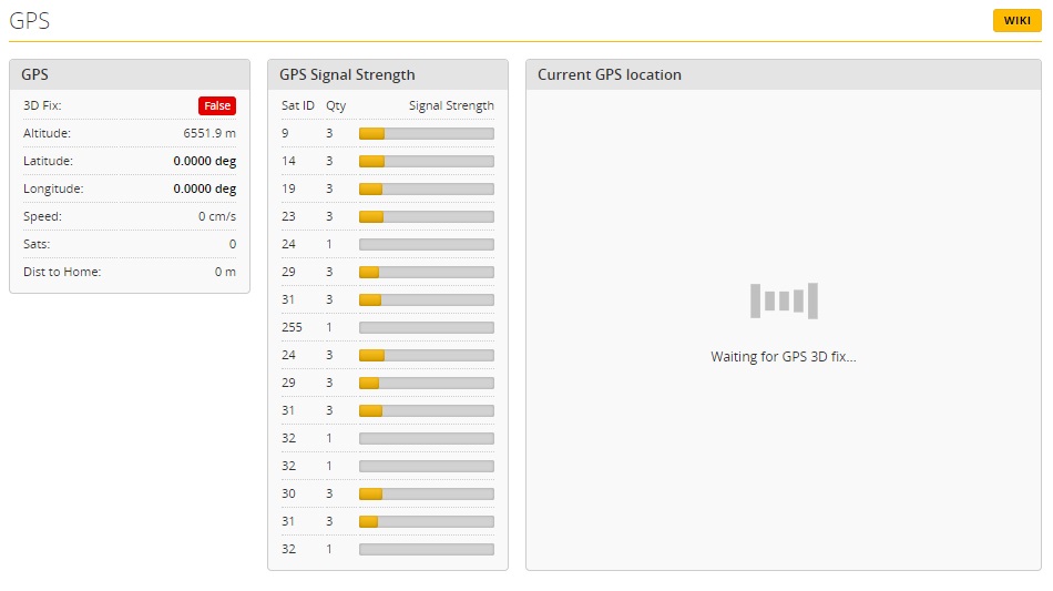
If you enable the expert mode (the small switch in the status bar. See above) then you can see the status of the GPS, the number and the strength of the received signals from the sattelites. Once you have GPS position fix (coordinates accuired) your gps modeule location will be shown on the map.
How to set up GPS in iNAV
Setting up the GPS in iNAV is very similar to Betaflight Configurator (see above).
In the Ports tab set the GPS Sensor input to the UART port where GPS is connected.
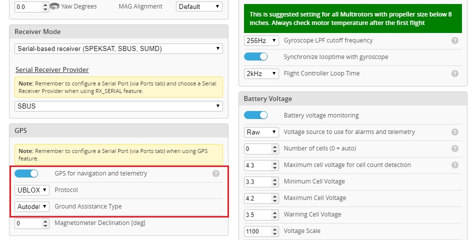
In the Configuration tab, enable GPS Feature. Select the GPS module communication protocol – UBLOX or NMEA. Set the the Ground Assistance Type to AutoDetect.
Also just like in the Betaflight Configurator, you can see if the GPS is set and working correctly by the status icon – it is active if the Flight Controller receives the data from GPS module.
GPS Modules on Banggood: https://www.banggood.com/search/gps-module.html
Beitian BN-180 datasheet – user manual: https://drive.google.com/file/d/1tWj_2m6fs9y0m_D4wA5g2vhxAzeyiuLy/view
Beitian BN-220 datasheet – user manual: http://www.sz-beitian.com/FileDownloadEng?path=%27Productsdoc/20210622100251.pdf
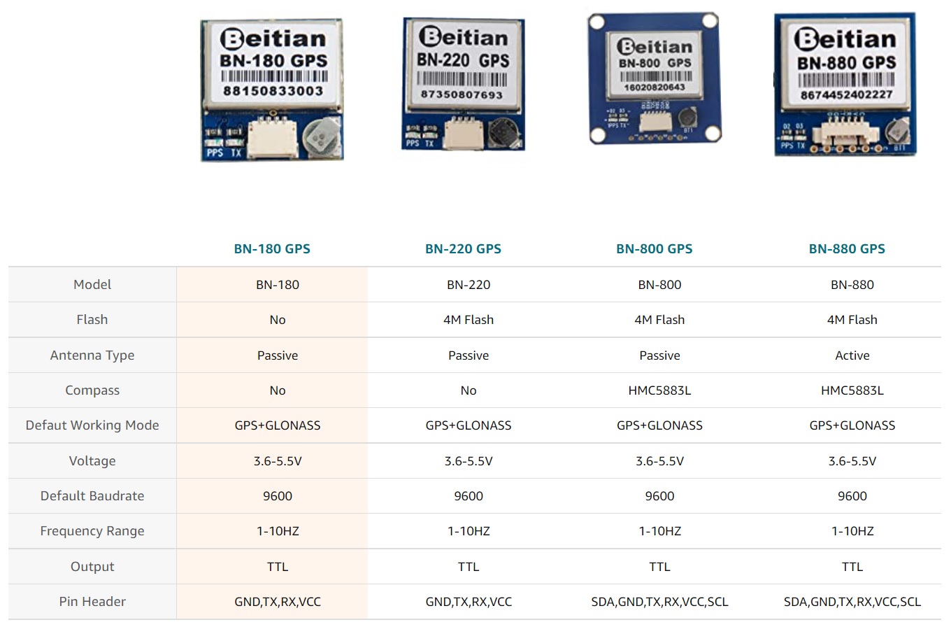
Beitian GPS modules comparison:



Why do these GPS modules have a transmit wire and an receive wire? I can see it sending the GPS signal to the FC (GPS TX to FC RX). But why 2-way communication between the FC and the GPS module (GPS RX to FC TX)?
Good question, Mark! Actually, yes, the GPS module should work with only TX connected to FC RX. This is only valid if your GPS module is preconfigured to transmit the needed data either from Betaflight or from GPS manufacturer software (U-Center for U-Blox GPS modules).
Also having the both TX and RX connected to the FC enables you to connect the GPS via “gpspassthrough” to the U-Center software. Not sure why would you need this, but who knows…
To be able to configure the GPS module, e.g. changing the G-force profile from “default” to “airborne”, or to change from the NMEA protocol to the UBX protocol.